Home Tags Posts tagged with "Floods"
Tag:

Floods

KeNHA

The Kenya National Highways Authority (KeNHA) has issued an urgent travel advisory following the heavy rainfall that was witnessed on the evening of Thursday, March 19, 2026.

In an advisory shared via social media at night, the authority warned that flooding and heavy silt deposits had disrupted a key section of the Mai Mahiu–Suswa–Narok (B7) Road.

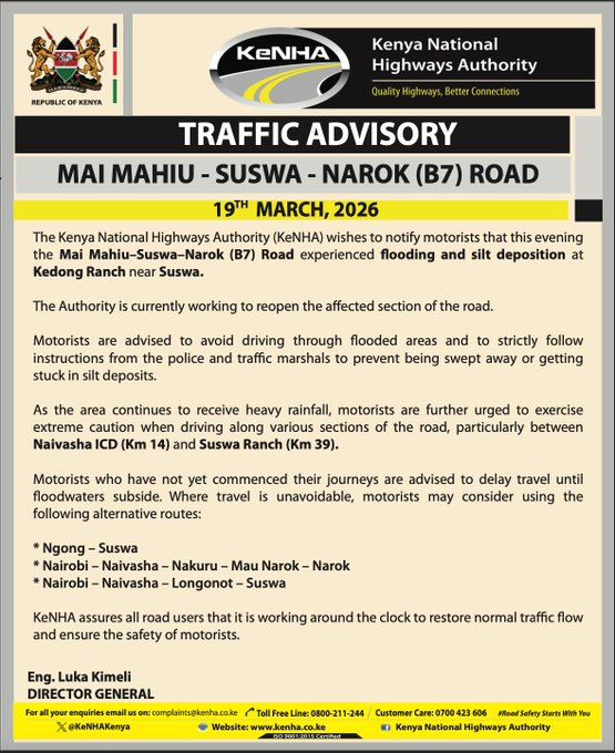
KeNHA said the affected section lies at Kedong Ranch near Suswa, where rising floodwaters and debris have made the road unsafe for motorists.

“The Kenya National Highways Authority (KeNHA) wishes to notify motorists that this evening the Mai Mahiu-Suswa-Narok (B7) Road experienced flooding and silt deposition at Kedong Ranch near Suswa. The Authority is currently working to reopen the affected section of the road,” KeNHA stated.

The authority confirmed that emergency teams have been deployed and are working to clear the silt and restore normal traffic flow.

“Motorists are advised to avoid driving through flooded areas and to strictly follow instructions from the police and traffic marshals to prevent being swept away or getting stuck in silt deposits,” the agency said.

The disruption comes amid ongoing heavy rains pounding parts of the country, with KeNHA warning that conditions remain dangerous, particularly along the stretch between Naivasha Inland Container Depot (Km 14) and Suswa Ranch (Km 39).

Drivers who have not yet begun their journeys have been urged to delay travel until the floodwaters subside.

For those with unavoidable trips, the authority has recommended alternative routes, including Ngong – Suswa, Nairobi – Naivasha – Nakuru – Mau Narok – Narok, and Nairobi – Naivasha – Longonot – Suswa.

KeNHA Director General Luka Kimeli also assured road users that the authority is working around the clock to ensure safety and reopen the road as soon as possible.

“KeNHA assures all road users that it is working around the clock to restore normal traffic flow and ensure the safety of motorists,” the statement read.

0 comment
0 FacebookTwitterPinterestLinkedinTumblrWhatsappTelegramEmail
Government Identifies 37 Flood-Prone Areas in Nairobi

The Ministry of Interior and National Administration has identified 37 neighbourhoods in Nairobi as flood-prone areas as heavy rains continue to pound different parts of the country.

According to the ministry, the areas were identified through a mapping exercise conducted under the Nairobi Rivers Regeneration Programme, which examined communities located along major river corridors and low-lying locations vulnerable to flooding.

In a statement issued on Sunday, March 15, 2025, the government warned that the ongoing rains have significantly increased the risk of flooding in both rural and urban areas, with Nairobi among the regions most exposed due to dense settlements and the presence of several rivers cutting through the city.

“Heavy rains continue to be experienced in different parts of the country, increasing the risk of flooding in both rural and urban areas, with Nairobi among the most affected. A mapping exercise conducted under the Nairobi Rivers Regeneration Programme has identified 37 neighbourhoods located along major river corridors and locations vulnerable to flooding,” the statement reads in part.

Flood-prone areas identified

In Nairobi East, the neighbourhoods flagged include Kiambiu, Dandora, Kariobangi, Kayole, Komarock, Njiru, Ruai, Mwiki, Donholm, Savannah, Tassia, and Fedha. Many of these areas lie downstream along sections of the Nairobi River and its tributaries.

“In Nairobi East, the areas identified include Kiambiu, Dandora, Kariobangi, Kayole, Komarock, Njiru, Ruai, Mwiki, Donholm, Savannah, Tassia, and Fedha, many of which lie downstream along sections of the Nairobi River and its tributaries,” the Interior Ministry stated.

In Nairobi West, the identified locations include Madaraka, Nairobi West, Lang’ata, Kawangware, Kangemi, Lavington, Westlands, Parklands, Kitisuru, Spring Valley, Kileleshwa, and Chiromo, which are situated along upstream and midstream sections of the river network.

For the Nairobi North corridor, neighbourhoods such as Mathare, Korogocho, and Lucky Summer were highlighted due to their proximity to the Mathare River, where dense settlements are located close to riverbanks.

“In Nairobi West, flood-prone locations include Madaraka, Nairobi West, Lang’ata, Kawangware, Kangemi, Lavington, Westlands, Parklands, Kitisuru, Spring Valley, Kileleshwa, and Chiromo, areas situated along upstream and midstream sections of the river network,” the government stated.

“In the Nairobi North corridor, neighbourhoods such as Mathare, Korogocho, and Lucky Summer have been identified along the Mathare River, where dense settlements closely border the river banks.”

Within Nairobi Central, the mapping identified areas including the Central Business District (CBD), Globe, Gikomba, Eastleigh, and the Industrial Area, where parts of the Nairobi River pass through heavily developed zones.

In Nairobi South, the neighbourhoods listed include Kilimani, Kibera, South C, South B, Mukuru Kwa Reuben, and Kwa Njenga, many of which lie along the Ngong River corridor.

Safety advisory to residents

The Interior Ministry said multi-agency disaster response teams are currently coordinating relief and response measures as heavy rainfall continues across the country.

Residents living near rivers, riparian zones, and low-lying areas have been urged to remain vigilant and take necessary precautions to safeguard their lives and property.

Authorities warned that flooding risks are particularly high in densely populated neighbourhoods where settlements extend close to riverbanks and drainage channels.

The government has urged Nairobi residents to prioritize safety during periods of intense rainfall, avoid crossing flooded areas, and follow guidance issued by emergency response teams.

Officials noted that the mapping exercise will also help guide future mitigation efforts, urban planning, and river restoration projects aimed at reducing flood risks across the capital.

0 comment
0 FacebookTwitterPinterestLinkedinTumblrWhatsappTelegramEmail
Bodies retrieved from vehicles along Kirinyaga Road

Over 18 bodies have been retrieved from vehicles along Kirinyaga Road in Nairobi following the devastating floods that struck the city on Friday, March 6, 2026.

Recovery efforts are still underway after many victims were swept away by fast-rising floodwaters, with some dying while inside vehicles that were carried away by the raging currents.

Nairobi Police Commander George Seda had earlier confirmed that 10 people had died but noted that the death toll could rise since recovery efforts were still underway.

According to the county police boss, at least 71 vehicles were trapped or stranded across the city after major roads became impassable due to the heavy flooding.

Speaking to Radio Citizen, Seda warned that the death toll could rise as search and rescue operations continue in several areas severely affected by the floods.

Residents across Nairobi woke up to flooded neighbourhoods, stranded motorists, and widespread disruption on Saturday morning after the heavy downpour left several parts of the city submerged and major roads impassable.

According to the Secretary General of the Kenya Red Cross Society, Ahmed Idris, multiple residential estates and informal settlements were severely affected as floodwaters surged through low-lying areas and along river corridors.

Among the hardest-hit areas were Pipeline and Embakasi, where floodwaters completely cut off sections of Kware Road. Other affected neighbourhoods include Mukuru Kwa Njenga, Reuben, Viwandani, Kibra, Mathare, Huruma, Baba Dogo, and Bosnia.

Flooding was also reported in South B and South C, Nairobi West, and Lang’ata, as well as Umoja 3, Chokaa, Njiru, Ruai, and Utawala. In the northern and western parts of the city, Roysambu along Kamiti Road, Kahawa West, Githurai, Loresho, and sections of Westlands also experienced rising waters.

0 comment
0 FacebookTwitterPinterestLinkedinTumblrWhatsappTelegramEmail

The weatherman has warned that Nairobi, Central Kenya and Coastal counties will experience heavy rainfall of more than 20mm beginning Wednesday, October 16, at 6am.

Besides the listed areas, the intensity of the rainfall is expected to hit at least 40mm in Western Kenya, North Eastern and South Eastern regions beginning Thursday, October 17, to Sunday, October 20 at 9pm.

Mombasa, Kwale, Kilifi, Tana River, Lamu, Nairobi, Nyeri, Kiambu, Nyandarua, Murang’a, Embu, Meru, Kirinyaga, Tharaka-Nithi, Kitui, Machakos, Makueni, Taita-Taveta, Busia, Kisii, Nyamira, Kericho, Bomet, Nakuru, Narok, Migori, Nandi, Trans-Nzoia, Uasin-Gishu, Elgeyo-Marakwet, Vihiga, Bungoma, Homa-Bay, Kisumu, Siaya, Kakamega, Kajiado, Nakuru, Marsabit, Mandera and Wajir are the counties that the Kenya Meteorological Department says will be hardest hit by the downpour.

“Residents in all the mentioned areas are advised to be on the lookout for potential floods,” said the Kenya-MET in a press statement to newsrooms.

“Flood waters may suddenly appear even in places where it has not rained heavily and can be deeper and faster than they look, especially in semi-arid and urban areas,” added the weatherman.

“Residents are advised to avoid driving through, or walking in moving water or open fields, and not to shelter under trees and near grilled windows to avoid exposure to lighting strikes,” said Kenya-MET.

The weather forecaster has advised Kenyans living in landslide-prone areas such as Mt Kenya and Central Kenya regions “to be on high alert”.

“The heavy rains and moderate to strong winds may result in storm surges along the Coast, hence fishermen and all the marine industry should be on high alert,” said the weatherman.

0 comment
0 FacebookTwitterPinterestLinkedinTumblrWhatsappTelegramEmail